London’s lost Tube stations, and where every station name comes from
The Underground has 272 stations. Since 1863, 44 others have closed or been moved. Some were demolished; others are still down there, and trains run past their platforms. Drag the years below to watch the network grow and the ghosts go dark, then look up where your station’s name comes from.
2026
272 stations open44 closed or moved
Open station
Closed, or old site of a moved station
Never opened
Main-line station once served by Tube trains
Closed route
Lines join neighbouring stations directly; they do not trace the tunnels.
Tap a station for its story. Pinch or use the buttons to zoom.
Lines join neighbouring stations directly; they do not trace the tunnels. Beyond the edge of the map, the Metropolitan line once ran 50 miles from Baker Street to Verney Junction in Buckinghamshire, and the District ran trains to Windsor and Southend.
Most of London’s lost stations closed because too few people used them, or because the station was rebuilt a short distance away. In the 1930s, when central stations were rebuilt with escalators and new entrances, a few of their neighbours were no longer needed. Several still stand, and from some trains you can see the platforms go by in the dark.
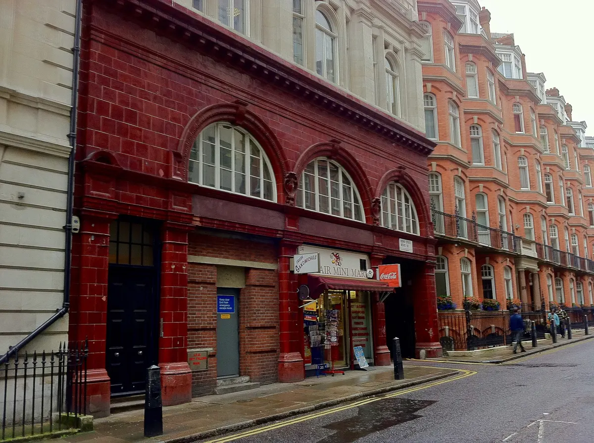
Down Street, 1907–1932
Between Green Park and Hyde Park Corner, Down Street was little used, and when its two neighbours moved their entrances closer to it, it closed, on 21 May 1932. In the Second World War the Railway Executive Committee worked down here, and Winston Churchill and the War Cabinet sheltered in it until the Cabinet War Rooms were ready. Churchill called it “the Barn”. The red-tiled building still stands just off Piccadilly.
Down Street today. Andrew Abbott, CC BY-SA 2.0, via Wikimedia Commons
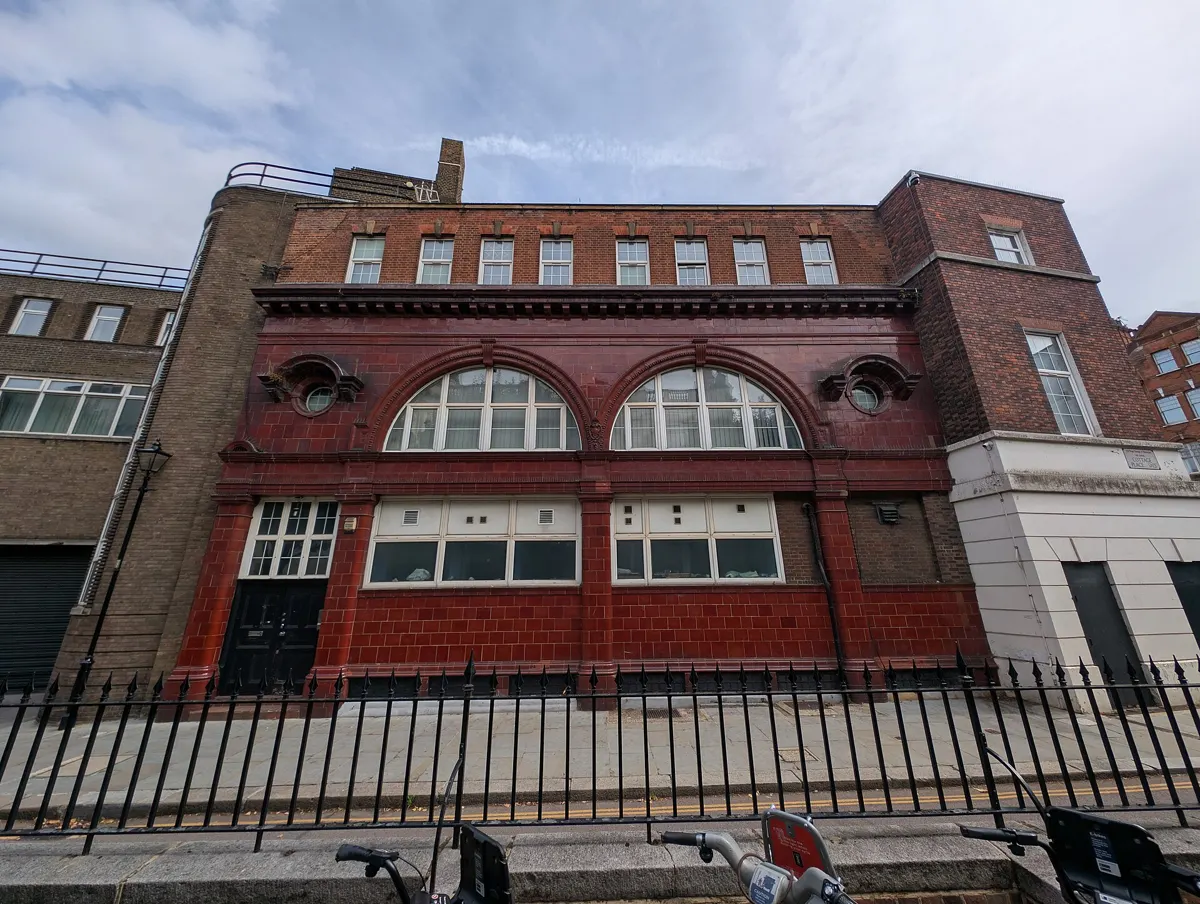
Between Knightsbridge and South Kensington. When Knightsbridge opened a new entrance nearby on 30 July 1934, Brompton Road closed. In the war it became the Royal Artillery’s anti-aircraft operations room for central London. The Ministry of Defence sold it in 2014.
What survives of Brompton Road station. Andy Li, CC0, via Wikimedia Commons
On the Central line under High Holborn. Holborn station, less than 100 yards away, was enlarged in 1933 to serve the Central line, and British Museum closed. Its surface building was demolished in 1989; a stretch of the old eastbound tunnel, visible from passing trains, stores track materials. A story that the ghost of an Egyptian princess haunts the tunnels is folklore.
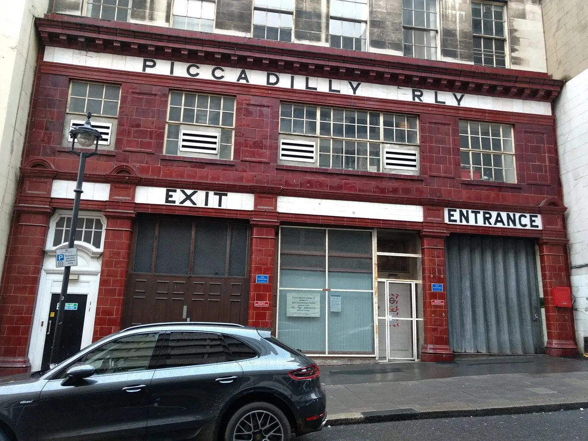
A short branch ran from Holborn to Aldwych, first called Strand. In the Second World War its tunnels stored treasures from the British Museum, including the Elgin Marbles. It closed on 30 September 1994, when replacing its lifts would have cost more than the station earned. It now appears in films, playing itself and other stations.
Aldwych’s Surrey Street entrance, still lettered for the Piccadilly Railway. Philafrenzy, CC BY-SA 4.0, via Wikimedia Commons
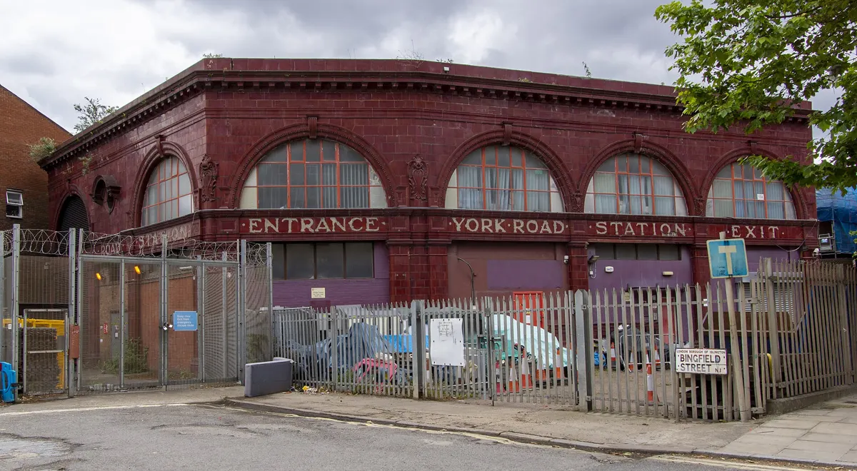
North of King’s Cross on the Piccadilly line. It closed in 1932, on the day the line was extended from Finsbury Park to Arnos Grove. The red building is still on York Way, and the tiled lift lobby survives inside.
York Road station on York Way. TheFrog001, CC0, via Wikimedia Commons
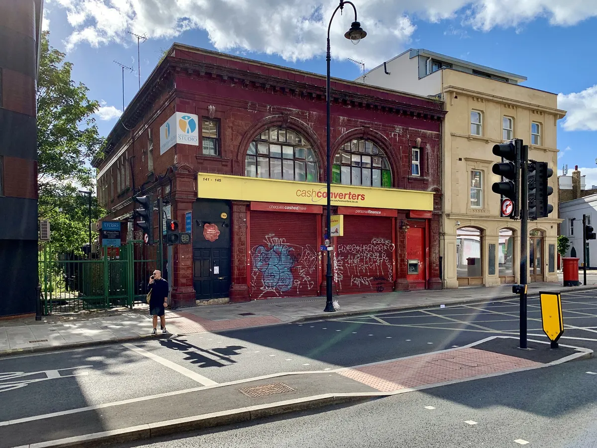
It shut on 5 June 1924, during a strike at Lots Road power station, and was never reopened. It was to have been called Castle Road, and that name had already been fired into its tiles. John Betjeman’s 1951 story of a passenger trapped in the empty station is fiction.
South Kentish Town, now a shop. TheFrog001, CC0, via Wikimedia Commons
The first terminus of the first deep tube, the City & South London Railway. Its tunnels were badly aligned, and it closed after nine years, when the line was extended to Moorgate. In the Second World War it was an air-raid shelter. The way in today is a manhole in the basement of an office building near Monument.
The Central line once ran beyond Epping into the Essex countryside. Blake Hall was the least used station on the network: about 17 passengers a day when it closed in 1981. North Weald and Ongar followed on 30 September 1994. Heritage trains run on the line today.
Between Hampstead and Golders Green, the tunnels for a station at North End were dug and never finished: in 1904 the land around it became part of Hampstead Heath, so the houses it was meant to serve were never built. At 221 feet (67 m) down, it would have been the deepest station on the network. It is also known as Bull & Bush, after the pub nearby.
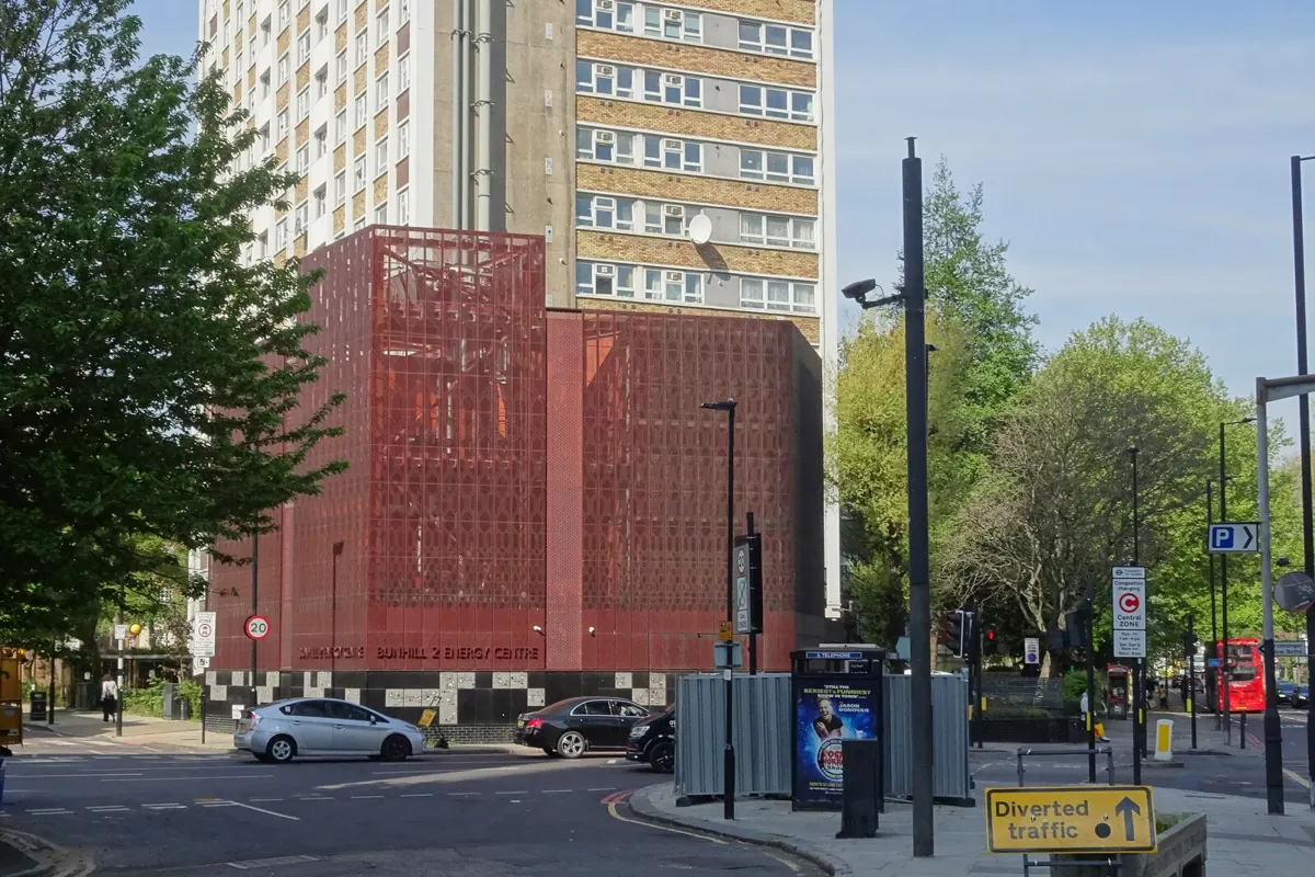
Between Angel and Old Street on the Northern line. Too few people used it, and it closed on 8 August 1922. Most of it was demolished in the 1960s, but its lift shaft was kept to ventilate the tunnels. That shaft is now doing something new.
The City Road station site today: Bunhill 2 Energy Centre. Nigel Thompson, CC BY-SA 2.0, via Wikimedia Commons
When the first tubes opened, the clay around the tunnels was about 14°C, the same as the rest of the ground. A century of trains has warmed it. Most of the heat comes from braking and from the motors, and the clay absorbs it; it is now 19–26°C. The Bakerloo line was advertised in 1906 with a maximum temperature of 60°F (16°C).
City Road’s old lift shaft became a ventilation shaft for the Northern line. Since 5 March 2020, a two-metre fan in that shaft has been drawing the warm tunnel air, at 18–30°C, over pipes filled with water. Heat pumps then raise the water to about 80°C, hot enough for radiators and taps, and a 1.5 km network of pipes carries it to the neighbourhood.
1,350
homes on the heat network, with a school and two leisure centres; 550 of them added by this plant
80°C
water leaving the energy centre
1.5 km
of new heating pipes
≈500 t
of CO₂ a year saved, Islington Council estimates
The plant, Bunhill 2 Energy Centre, stands on the old station site at City Road and Central Street. It also generates electricity: its combined heat and power units feed some of it into the Underground, and some to the lifts and lighting of a tower block next door.
In summer the fan can be reversed to push cooler air down into the tunnels. Islington Council calls the scheme the first of its kind in the world. Transport for London has studied 56 of its ventilation shafts for the same use, and has looked in detail at the six most promising.
Tap any name. Each station’s name is sorted by what it refers to: a pub, a church, a river, a Saxon farmstead, a road, or a name the railway made up. Where the sources disagree about a name, the card says so.
Hampstead is the deepest station below ground level. North End, which never opened, would have been deeper, at 221 feet (67 m).
Highest147 m
Amersham, at the end of the Metropolitan line, is the highest station above sea level, higher than the top of the Big Ben tower.
Longest escalator60 m
Angel’s escalators, the longest of the Underground’s 426. They took the title from Leicester Square’s 54 m when Angel was rebuilt in 1992.
Shortest hop260 m
Leicester Square to Covent Garden on the Piccadilly line is the shortest distance between two neighbouring stations.
Longest hop6.3 km
Chesham to Chalfont & Latimer on the Metropolitan line: 3.89 miles between neighbouring stations, the longest gap on the network.
Oldest1863
Seven stations opened on 10 January 1863: Baker Street, Edgware Road, Euston Square, Farringdon, Great Portland Street, King’s Cross St Pancras and Paddington.
Busiest72.5m
King’s Cross St Pancras had 72.51 million entries and exits in 2025, ahead of Waterloo with 69.77 million.
All five vowels2
Only two station names contain a, e, i, o and u: Mansion House and South Ealing.
No mackerel1
St John’s Wood is the only station name that shares no letter with the word “mackerel”.
Underground?45%
Only about 45% of the London Underground actually runs underground.
The list of open stations, their opening dates, lines and earlier names comes from Wikipedia’s list of London Underground stations, which draws on Douglas Rose’s diagrammatic history and Cyril Harris’s What’s in a Name?. Closed and moved stations come from Wikipedia’s list of former and unopened stations. Coordinates come from each station’s Wikipedia article.
Each name origin was written from the station’s article and the article on the place it serves, and each statement is tied to a sentence in those articles; a script confirms that every quoted sentence is there. Where the articles give competing explanations, the card says so. Place-name meanings are those given in the articles, which mostly follow A. D. Mills’s Dictionary of London Place Names.
On the map, a section of line appears once both of its stations have opened; sections built later between stations that already existed (the Victoria line, the Jubilee line, the Piccadilly line’s western branches) appear in the year they opened. For closed stations and main-line stations once served by Tube trains, each record shows only for the years when Underground trains served that site, with each year taken from a quoted source; where no source gives the start, the station appears only when it closes, never before. Stations that moved have a separate record for the old site. Line routes are TfL’s; they join stations with straight lines, so the map shows where lines go, not the exact curve of each tunnel.
The City Road chapter uses Islington Council’s announcement of 5 March 2020 and the heat pump maker’s published figures; the tunnel temperatures come from a CIBSE Journal article and the published research summarised by Wikipedia.
Down Street today: Andrew Abbott, CC BY-SA 2.0, via Wikimedia Commons
What survives of Brompton Road station: Andy Li, CC0, via Wikimedia Commons
Aldwych’s Surrey Street entrance, still lettered for the Piccadilly Railway: Philafrenzy, CC BY-SA 4.0, via Wikimedia Commons
York Road station on York Way: TheFrog001, CC0, via Wikimedia Commons
South Kentish Town, now a shop: TheFrog001, CC0, via Wikimedia Commons
The City Road station site today: Bunhill 2 Energy Centre: Nigel Thompson, CC BY-SA 2.0, via Wikimedia Commons
Bunhill 2 Energy Centre, on the site of City Road station: The wub, CC BY-SA 4.0, via Wikimedia Commons
Baker Street, one of the seven stations of 1863: Unknown author, Public domain, via Wikimedia Commons
Londoners sheltering underground during the Blitz, 1940, probably at Aldwych: Ministry of Information Photo Division Photographer, Public domain, via Wikimedia Commons